LIGTAS METRO
Fall 2026Flood-aware commute radar and road passability platform for Metro Manila.
overview
Metro Manila's major thoroughfares flood within minutes during Habagat and typhoon season, leaving commuters and motorists stranded without localized ground-truth data. LIGTAS METRO is a flood-aware commute radar and road passability platform engineered for the National Capital Region, grounded in Project NOAH, DOST-PAGASA, MMDA EFCOS, and Open-Meteo GLoFAS hydrological telemetry.
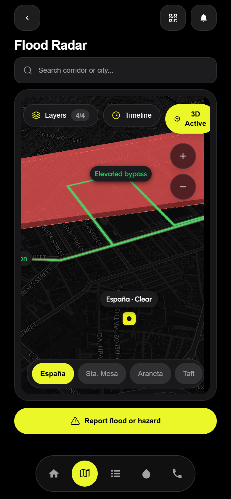
The platform pairs a high-contrast MapLibre GL 3D spatial hazard radar (supporting dynamic pitch tilt, flood elevation polygons, and OpenFreeMap vector tiles) with 360° street-level baselines via Mapillary v4 so commuters can visually compare dry-weather road clearances against live water gauges across España, Sta. Mesa, Araneta, Taft, Katipunan, and the Marikina River Basin.
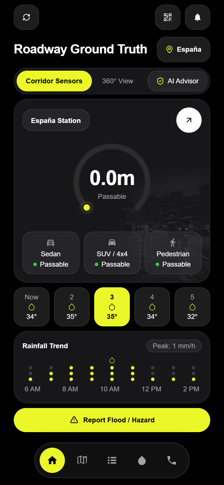
It computes a deterministic vehicle passability matrix for Pedestrians (<0.15m), Sedans (<0.20m), and SUVs/4x4s (<0.50m), alongside a 9-column rainfall trend matrix, river discharge forecasts, one-tap emergency dispatch hotlines (911, MMDA 136, Red Cross 143), and a deterministic RAG safety advisor powered by Gemini Flash.
architecture & capabilities
Roadway Ground Truth & Passability Matrix
Live water depth gauges with deterministic clearance thresholds for Pedestrians, Sedans, and SUVs/4x4s across flood-prone NCR corridors.
MapLibre GL 3D Flood Radar
Interactive 2D/3D vector basemap overlaying flood hazard polygons, river stage stations, and rainfall intensity contours.
360° Photometric Street View Baselines
Integrated Mapillary v4 street-level panoramic imagery and compass bearings for verifying physical roadway elevation.
Deterministic RAG Safety Advisor
Conversational route safety assistant powered by Gemini API with an offline hydrological fallback engine and official PAGASA alert citations.